


Voting District 10015, Contra Costa County, California
About
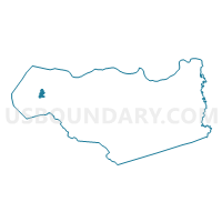
Outline

Summary
| Unique Area Identifier | 529553 |
| Name | Voting District 10015 |
| County | Contra Costa County |
| State | California |
| Area (square miles) | 1.52 |
| Land Area (square miles) | 1.52 |
| Water Area (square miles) | 0.00 |
| % of Land Area | 100.00 |
| % of Water Area | 0.00 |
| Latitude of the Internal Point | 37.97362090 |
| Longtitude of the Internal Point | -122.30516360 |
Maps


Graphs
Select a template below for downloading or customizing gragh for Voting District 10015, Contra Costa County, California


Neighbors
Neighoring Voting District (by Name) Neighboring Voting District on the Map
- Voting District 10020, Contra Costa County, CA
- Voting District 10030, Contra Costa County, CA
- Voting District 10095, Contra Costa County, CA
- Voting District 10135, Contra Costa County, CA
- Voting District 10145, Contra Costa County, CA
- Voting District 10150, Contra Costa County, CA
- Voting District 10155, Contra Costa County, CA
- Voting District 10170, Contra Costa County, CA
- Voting District 10210, Contra Costa County, CA
- Voting District 10215, Contra Costa County, CA
- Voting District 10270, Contra Costa County, CA
- Voting District 10310, Contra Costa County, CA
- Voting District 20665, Contra Costa County, CA
- Voting District 20690, Contra Costa County, CA
Top 10 Neighboring County Subdivision (by Population) Neighboring County Subdivision on the Map
Top 10 Neighboring Place (by Population) Neighboring Place on the Map
Top 10 Neighboring Unified School District (by Population) Neighboring Unified School District on the Map
Top 10 Neighboring State Legislative District Lower Chamber (by Population) Neighboring State Legislative District Lower Chamber on the Map
Top 10 Neighboring State Legislative District Upper Chamber (by Population) Neighboring State Legislative District Upper Chamber on the Map
Top 10 Neighboring 111th Congressional District (by Population) Neighboring 111th Congressional District on the Map
Top 10 Neighboring Census Tract (by Population) Neighboring Census Tract on the Map
- Census Tract 3630, Contra Costa County, CA (7,043)
- Census Tract 3602, Contra Costa County, CA (4,626)
- Census Tract 3601.01, Contra Costa County, CA (4,576)
- Census Tract 3610, Contra Costa County, CA (4,475)
- Census Tract 3690.02, Contra Costa County, CA (2,548)